Visit our new location at 920 2nd Ave E in the Owen Sound River District
Your cart is currently empty
Product image slideshow Items

Map of Algonquin Park's early borders and lakes.
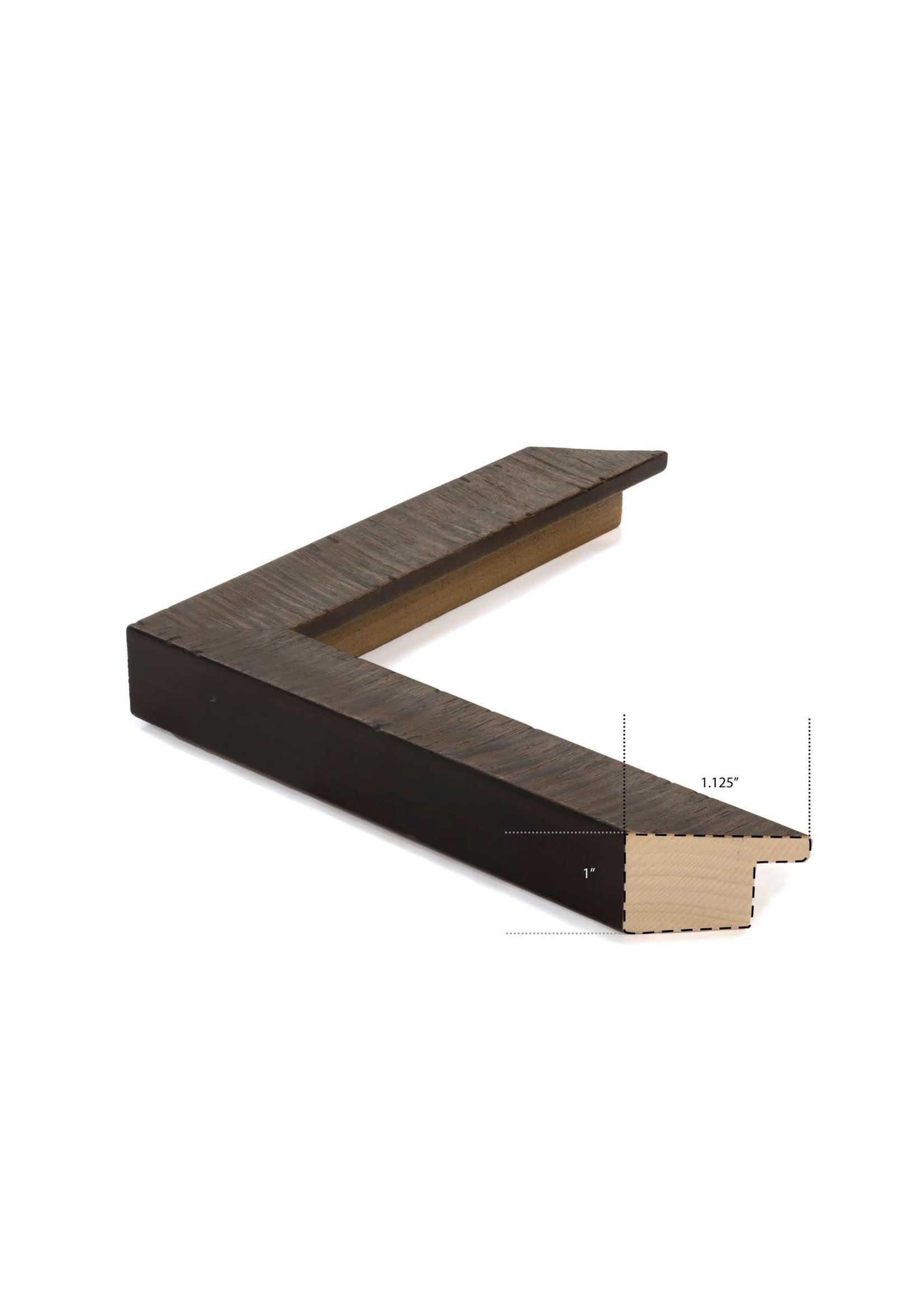
This lovely, hand-tinted Algonquin Park map of watery blues and soft ivories invites you to look closer at its unique character. History buffs will enjoy comparing these early boundaries against the current ones. Produced by the Government of Ontario in 1958. Framed in a rustic live edge, dark stained profile.
Outside Dimensions: 51.5 x 37.5"